Mosshead, Gartconnell, North and South Baljaffray: four lost farms north of Bearsden
I found this fascinating map on the Scotland's People website. It is dated 1945 and was part of a series covering farmland in Scotland. In the area I have selected above you can see Schaw House bottom right, Edgehill Road immediately to the right of that and parallel to the right of that, Gartconnell Road. The black buildings marked on the extreme right, just above the marking "30" on the vertical side of the map, is Gartconnell Farm. Heading north (and just below the letter C in KILPATRICK is Mosshead Farm. Going north again to the top of the photo is South Mains Farm (still a working farm in 2024) on Craighdu Road. Following this road left to the then crossroads (now a busy roundabout) and going straight across into what we now call Baljaffray Road you can see another two farms, North Baljaffray and South Baljaffray.
All the photos are taken from air the Britain from Above website
GARTCONNELL
The first photo of Gartconnell is from 1928:
We are looking from the south. Schaw House is just visible top left; Gartconnell Farm buildings are in the top right, surrounded by fields. The nearest houses to the farm, slightly closer to the camera, are the western end of Ralston Road.
The next views are from 1952. The first is a slightly wider shot to show the context:
We are looking from the north; Edgehill Road just cuts across the bottom right of the photo and Gartconnell Road runs from bottom left to top right. The prominent line of trees running top left across the upper half of the photo is the line of Ralston Road. The houses at the very top of the photo are on the north side of Manse Road. The farm buildings are evident just to the east of Gartconnell Road. What is now called Elm Walk (nearer to the camera) separates the farmhouse (still standing) from other buildings which cover most of the area down to Russell Drive (closer to Ralston Road).
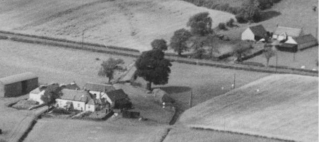
Schaw House is prominent at the bottom of the photo. Above and to the left are the parts of Baillie Drive, Dumgoyne Drive and Heather Avenue that had been built at that time. Mosshhead Farm is the cluster of buildings in the top right.
Note the track running north from Mosshead Farm to South Mains Farm, the first part probably marks the east side of today's Heather Park to the line of the trees. The part beyond the trees is still signposted as a right-of-way.
This view includes the cottages still standing on the south side of Baljaffray Road in 2024 (in the very top left of the photo):


Comments
Post a Comment